Project Spotlight – SLVWD Pipeline Replacement, Boulder Creek, CA
Kier + Wright Provides Multi-Faceted Comprehensive Survey Approach for Boulder Creek Pipeline Replacement Project
Over the last 10 years, forest fires have become a common occurrence, causing billions of dollars in damage to public infrastructure and private properties – ravaging towns and communities across the state. In 2020, the community of Boulder Creek was severely affected by the CZU Lightning Complex Fires which burned over 86,000 acres and destroyed over 1,490 structures and miles of infrastructure throughout the community. The fire damage resulted in the San Lorenzo Valley Water District (SLVWD) prioritizing previously planned capital improvements to their aging infrastructure that would incorporate best practices in resiliency design. As such, the SLVWD Pipeline Replacement Project was moved to the top of the Capital Improvement Projects priority list.
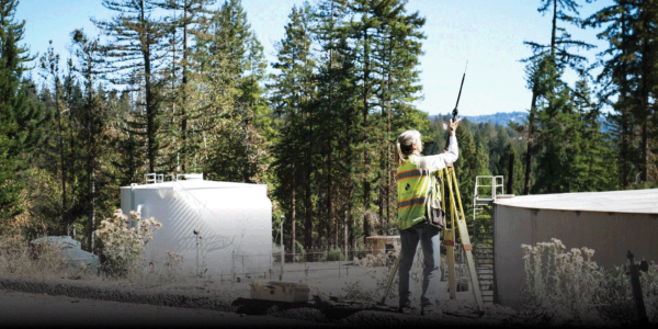
SLVWD hired Kier + Wright (K+W) to provide a comprehensive, detailed land survey of all features and grades along the future watermain alignment including elevations, material changes and structures. The biggest challenge facing the K+W project team was gathering and compiling accurate survey data while navigating the rugged, mountainous terrain of the Santa Cruz mountains and the dangerous highway corridors that snake through it.
As experts in survey technology, K+W customized its approach to cost-effectively meet the needs of SLVWD and the Boulder Creek community while delivering quicker, better, and more innovative results. The K+W multi-faceted approach included seamlessly integrating traditional and new surveying methods; combining various survey technologies such as Fixed Wing and Multi-Rotor Drones, GPS Locating and 3D scanning – using the right technology and approach where applicable.
The Fixed Wing, which can cover over 400 acres an hour, along with Multi-Rotor Drones were used to map out over 200 acres of dense forest vegetation in Boulder Creek. The usage of drones allowed K+W to photograph the site from a lower altitude than a traditional aerial survey, resulting in higher resolution orthoimagery of the entire project area. These aerial images provide planning level data of the spaces between the areas of critical design, showing the full scope and scale of the project in relation to the larger site.
The challenge with an aerial survey in mountainous terrain, is that the dense tree cover severely limits elevation data from the ground. The Terrestrial Lidar Scanner (TLS) used along corridors critical to the new watermain, enabled K+W to create a survey that showed information from both above and below the tree canopy. This ground-based imaging method was used to acquire accurate, dense 3D point clouds of object surfaces by laser range finding. Capturing thousands of points of data per second, beyond the project scope requirements, that the engineering design teams can refer to in the future should the scope expand or change. In addition, utilizing the 3D scanner allowed K+W to collect vast amounts of data quickly and safely, while ensuring our crew’s safety on the dangerous winding mountain roadways which are at a high risk of accidents due to blind corners.
Using a mix of conventual and innovative surveying techniques that combined multiple different software platforms, K+W produced an extensive and user-friendly survey for SLVWD. The comprehensive survey was delivered on time and on budget which prevented delays in SLVWD’s capital improvement projects, by providing future engineering and architectural teams with the information they need to design solutions creating a safer and more resilient community.
To learn more about this project, please view the video above.
